Watershed Protection Plan:
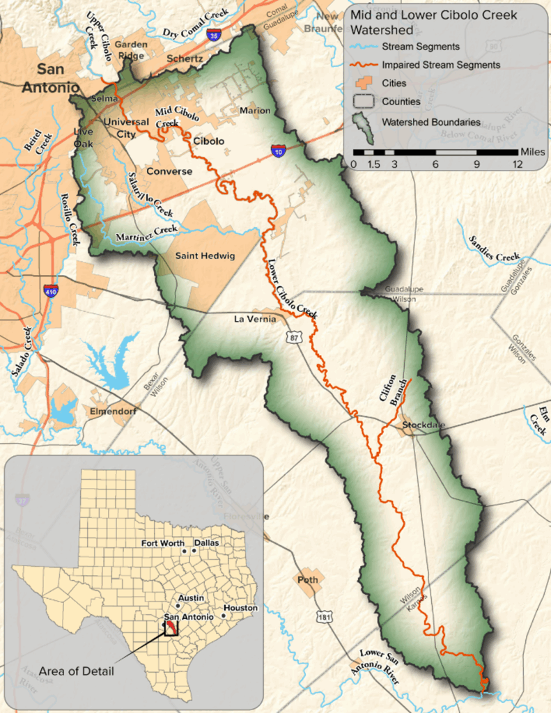
The Mid and Lower Cibolo Creek watershed covers parts of Guadalupe, Bexar, Wilson and Karnes counties. The headwaters of the watershed are in the developing I-35 corridor north and east of San Antonio. Cibolo Creek meanders south approximately 90 stream miles before its confluence with the San Antonio River and includes Martinez Creek, Salatrillo Creek and Clifton Branch.
The Texas Commission on Environmental Quality (TCEQ) has listed the Lower Cibolo Creek as an impaired water body for primary contact recreation due to elevated levels of E. coli bacteria. The watershed also has concerns for elevated levels of nitrate, total phosphorus and depressed dissolved oxygen levels, which can hinder aquatic life.
With this project, TWRI and the San Antonio River Authority (SARA) worked together to assist local stakeholders in the development of a watershed protection plan (WPP), which identified the best management practices to achieve the water quality improvement and watershed protection goals identified by stakeholders.


Upcoming events:
- Keep an eye out for an upcoming stakeholder meeting!


